AIRBUS DEFENSE AND SPACE

Helios II Military Observation Satellite
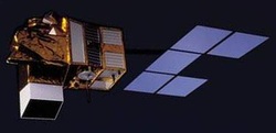
Helios 2 is
the second generation of the European military optical reconnaissance system. The
Helios 2 system comprising two optical satellites and a user ground segment
developed under Astrium prime contractorship, provides a number of key
enhancements including higher resolution, infra-red imaging capability for
night detection and shorter revisit cycles.
Helios 2 marks not only a considerable advance in Europe’s ability to obtain military space observation data, but also a new dimension for European defence. As a result of innovative bilateral international agreements, data access rights will be exchanged between the Helios II optical system and the German SAR-Lupe and Italian COSMO-SkyMed radar systems.
Helios 2 marks not only a considerable advance in Europe’s ability to obtain military space observation data, but also a new dimension for European defence. As a result of innovative bilateral international agreements, data access rights will be exchanged between the Helios II optical system and the German SAR-Lupe and Italian COSMO-SkyMed radar systems.
Pleiadus Military Observation Satellite
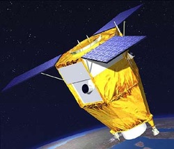
The SPOT-5
optical Earth observation satellite combines the advantages of a relatively
wide imaging swath and sub-3-metre resolution. Today, new and evolving civil
and military challenges facing Europe call for different levels of image
resolution.
The Pleiades optical satellites will provide imagery covering a smaller area but with a resolution of 0.70 m.
Together, SPOT and Pleiades will offer a broader range of complementary data better able to meet the diverse requirements of civil users, for example, cartographers, volcanologists, geophysicists, hydrologists and urban planners, and military users.
The Pleiades optical system is being developed under CNES supervision as part of a joint effort with Italy, alongside the Cosmo-Skymed radar imaging system that is under the responsibility of the Italian space agency (ASI).
Composante Spatial Optiqu Military Observation Satellite
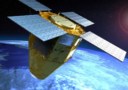
Astrium has been awarded a contract to supply satellites in the optical space component (CSO) program, intended to replace the current military observation satellites Helios 2 used by the French armed forces and its partners.
As prime contractor for the CSO satellites program, Astrium will provide the agile platform and avionics, and will be responsible for integration work, testing and delivery of the satellites at the National Centre for Space Studies ( CNES) , on behalf of the Directorate General of Armaments (DGA). Thales Alenia Space (TAS) will provide Astrium optical high-resolution instrument.
The extensive use of new technologies will enable the satellites to be numerous times more powerful than the current generation, while also reducing costs. The satellites are based on the latest technologies and utilize the operational experience gained throughout the year, while also reduce costs by as much as 30%.
The latest generation of gyroscopic actuators, fiber optic gyroscopes, onboard electronics and control software will optimize the mass and inertia of satellites, and significantly improve the speed. The extreme agility and stability of satellites will allow them to quickly provide users with images of very high quality , even for the most complex environments and situations.
ELISA Sattelite
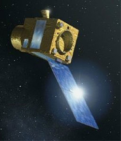
Elisa is a
demonstration project sponsored by the French defence procurements agency (DGA).
It will prepare the ground for the future operational programme ROEM (Elint)
for mapping the positions of radar and other transmitters throughout the world
and determining their technical characteristics.
Elisa involves Elint payloads which will be carried on board micro-satellites. These will be placed in Low Earth Orbit a few kilometres from each other and will record all signals intercepted. When the measurements stored by each micro-satellite are combined, it will be possible to locate and characterise the source of each signal.
The ground segment is made up of two connected units, one for controlling the satellites and transmitting operating schedules, the other for preparing the schedules and processing the measurements.
